Fosiva, the French risk prevention app !
FOSIVA provides real-time information on forest closures, fire risks, weather warnings, and flooding in 13 departments in the South.
Download the FOSIVA app for free!
![]()

FOSIVA provides real-time information on forest closures, fire risks, weather warnings, and flooding in 13 departments in the South.
![]()
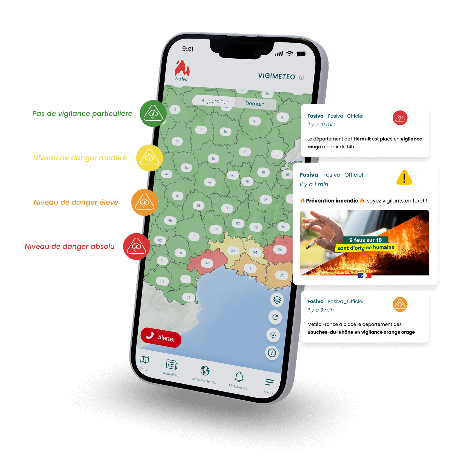

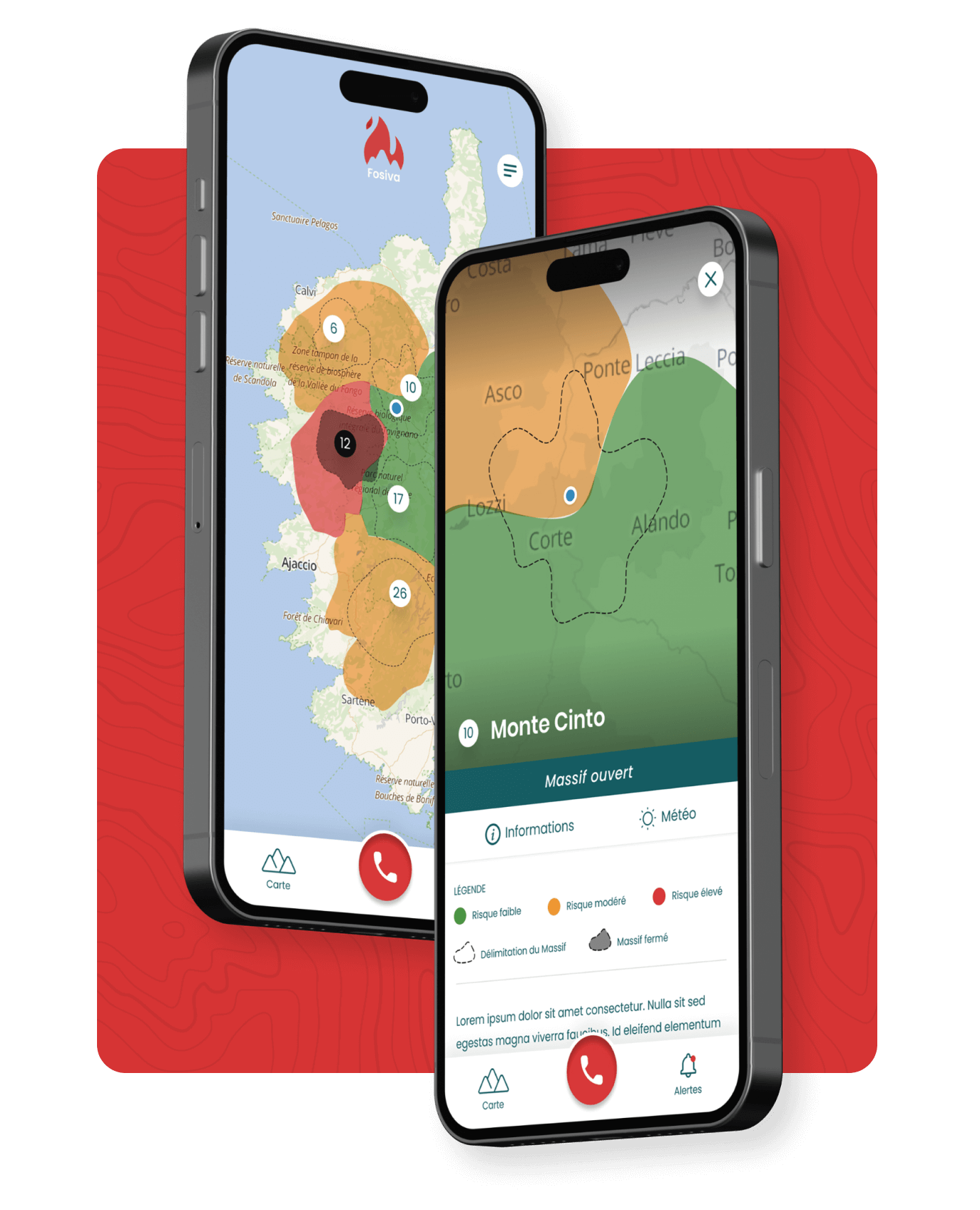
View current risks around you: fire risk, weather warnings, flooding, etc. A simple and intuitive map, powered by official data.
You’ll receive weather warnings, mountain closures, and alerts for other major events in real time.
Go to the “Right Actions” tab to find the right behaviors to adopt when facing risks.

All information disseminated by FOSIVA comes from reliable sources: Entente Valabre, prefectures, Météo-France, Vigicrues, etc.

Take charge of your safety and that of others. Report a fire, accident, or hazard in real time.
Today, with the increase in extreme events that contribute to various hazards, it is essential to better inform citizens. Fosiva is a prevention app that allows users to quickly and easily understand hazards.
For the app’s creator, it was important to integrate risk prevention into their daily lives through a simple tool: their smartphone!
With FOSIVA, stay informed and responsive to natural hazards in the following departments:
04 – Alpes-de-Haute-Provence
06 – Alpes-Maritimes
11 – Aude
13 – Bouches-du-Rhône
2A – Corse-du-Sud
2B – Haute-Corse
26 – Drôme
30 – Gard
34 – Hérault
66 – Pyrénées-Orientales
81 – Tarn
83 – Var
84 – Vaucluse
The FOSIVA app is designed to aggregate information from all organizations involved in protecting and raising awareness among the public. It allows you to raise awareness and stay informed about the risks around you.
📍 Activate geolocation to receive targeted alerts based on your location.
🗺️ Consult the interactive map and locate risk areas.
🔔 Receive alert notifications and important events.
📷 Get live alerts in 3 clicks using your GPS location.
✅ Access the “Good Actions” tab to adopt the right behaviors in the face of risks.
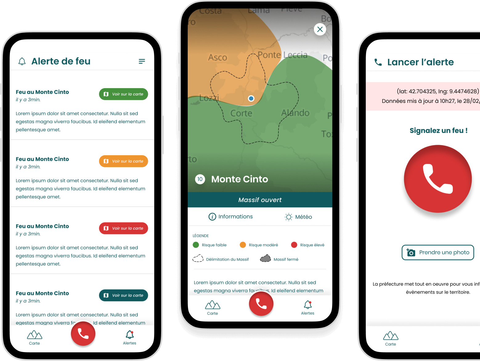

Each zone is identified by a color code:
A risk may exist, but the impact is limited. No specific measures.
Monitoring is recommended. Adopt prudent behaviors.
Significant risk. Prepare yourself and limit certain activities.
Major risk. Avoid the affected areas and follow official guidelines.
Risk levels are updated daily based on weather data.

Prevention also means knowing the right reflexes!
FOSIVA doesn’t just alert you. The app also guides you on what to do in case of risk: fire, submersion, storm, heatwave, dangerous wildlife, etc.
In the “Good Actions” tab, you’ll find clear, practical information sheets translated into several languages:
What to do in case of a jellyfish sting? What if you feel unwell?
How to react in the event of a nearby fire?
What species are protected in the South region?
💡 Because being well-informed already means being better protected.
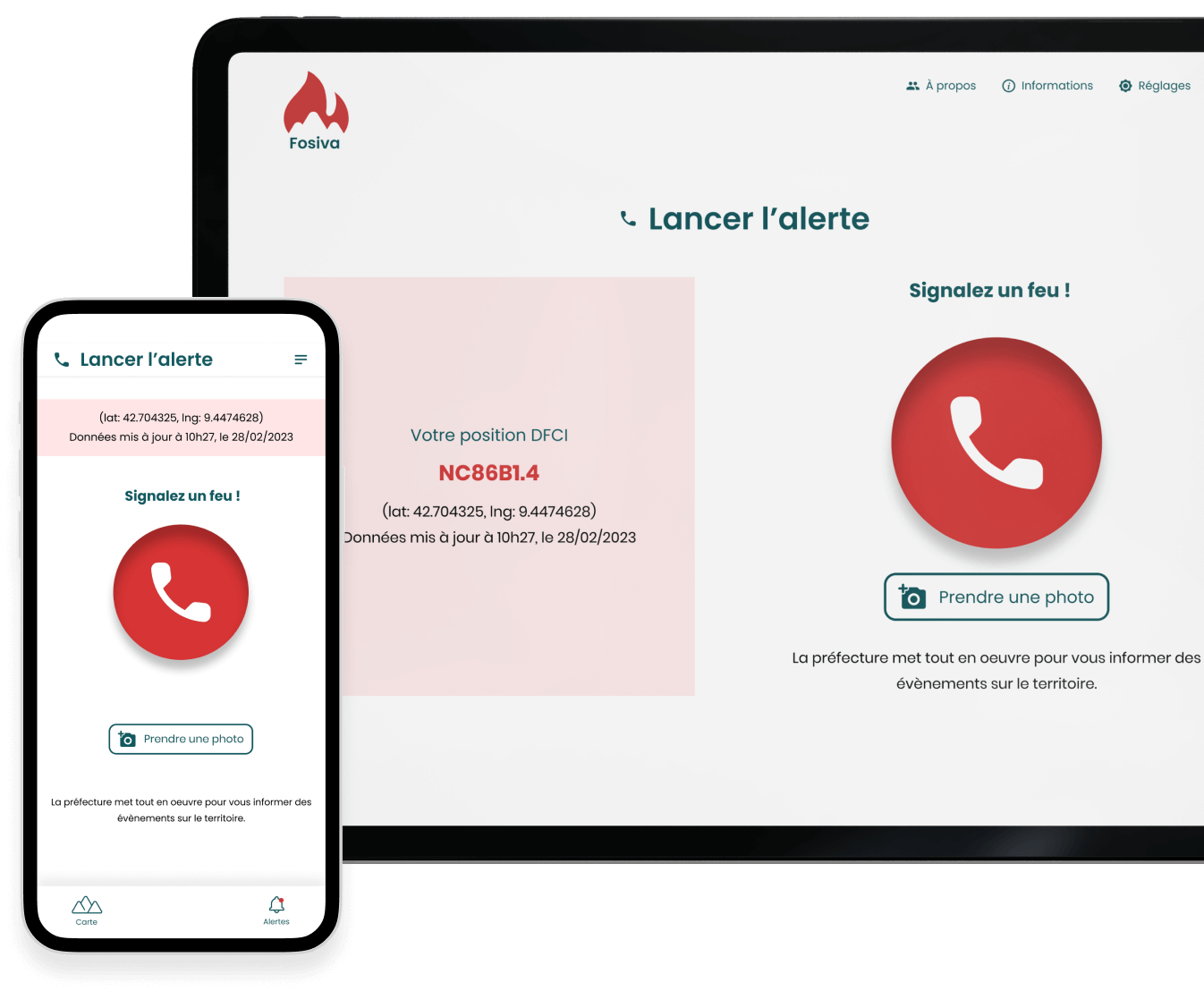
FOSIVA allows you to report a hazard or incident in real time. In just a few clicks, you can send an alert along with your precise GPS and DFCI coordinates.
🔥 Example: Have you witnessed a fire? Click on the “Alert” tab, describe the situation, and instantly send your location to emergency services.
📷 A future feature will also allow you to attach a photo, useful for quickly assessing the situation.
🕒 This simple and quick-to-use system reduces response time and improves emergency response coordination.